East Chicago Station
South Shore Line
East Chicago, Indiana
Last Updated: October 2023
TOD Strategic Implementation Plan
Following the TDD boundary being established October 31, 2022, the team worked closely with the City of Each Chicago to identify and collaboratively advance planning for the community to be proactive about future TOD.
At the conclusion of this process, control of local land use and zoning remains with the cities and towns. This process aims to provide proactive guidance and recommendations that the local units can use to advance their planning processes, resulting in updated comprehensive plans, area plans, and zoning ordinances complete with locally-controlled public input.
Community Priorities & Opportunities
Big Moves
“Big Moves” are defined as enabling steps to signal to the market that conditions are right for transit-oriented development to occur.
Opportunities around the East Chicago Station consist of a mix of uses at low- to medium-densities within the Roxana Neighborhood west of the station. North of the Grand Calumet River, several industrial sites have the potential for redevelopment to support high-quality, dense housing. Streetscape and traffic improvements along Indianapolis Boulevard can enhance connectivity and walkability to the station from neighborhoods north of the river. Improvements in the Roxana Neighborhood should focus on strengthening commercial opportunities along Indianapolis Boulevard and creating safe connections to the station across Indianapolis Boulevard. Continued cleanup of the Grand Calumet River has the potential to transform the riverfront into a tremendous community asset.
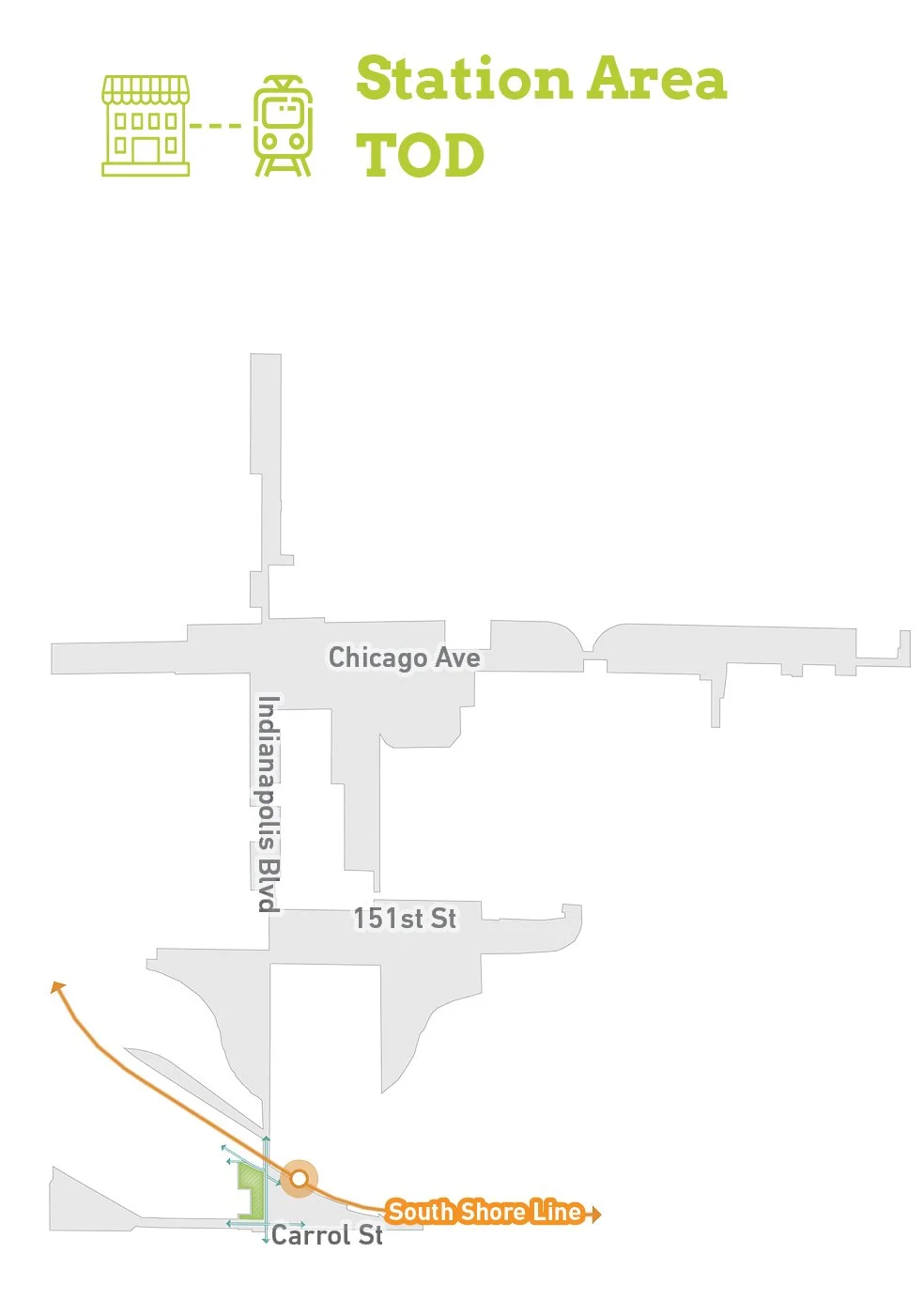


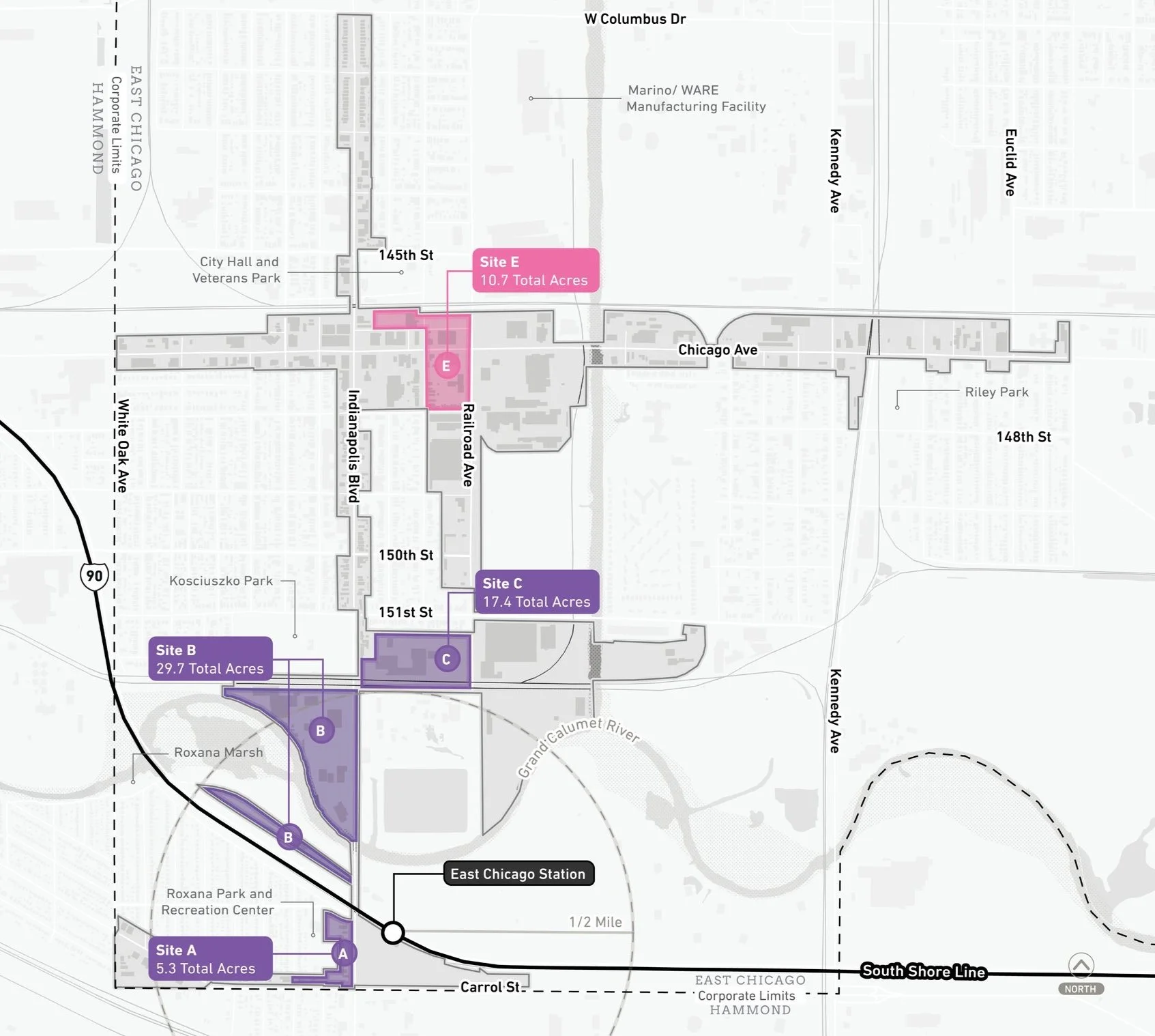
Areas of Impact
Areas of Impact were established to distinguish between major (re)development areas, both TOD and non-TOD, and areas to be maintained, preserved, and enhanced. These designations begin to direct development activity and other targeted investments based on proximity and relationship to the station area.
Several sites along the west side of Indianapolis Boulevard near the East Chicago Station have the potential to be redeveloped into walkable TOD complementary to the existing Roxana Neighborhood and Roxana Park. Additional sites are situated along the existing and proposed Marquette Greenway alignment, which would become an attractive amenity for residents and visitors. To the north, Chicago Avenue presents an opportunity to redevelop a former senior housing site and activate a key intersection to bring more life to the Chicago Avenue corridor.
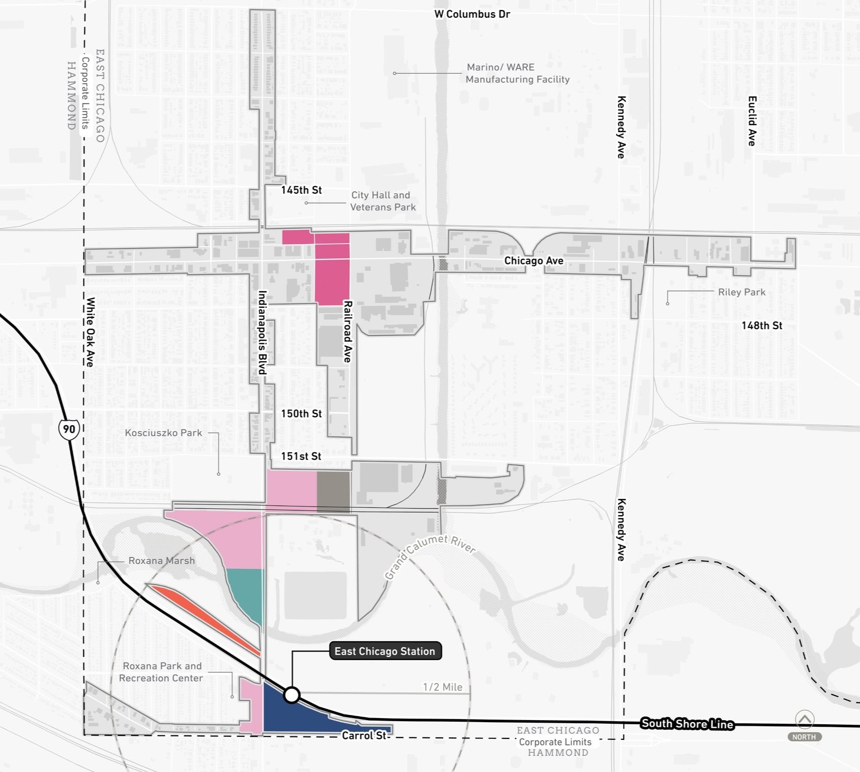
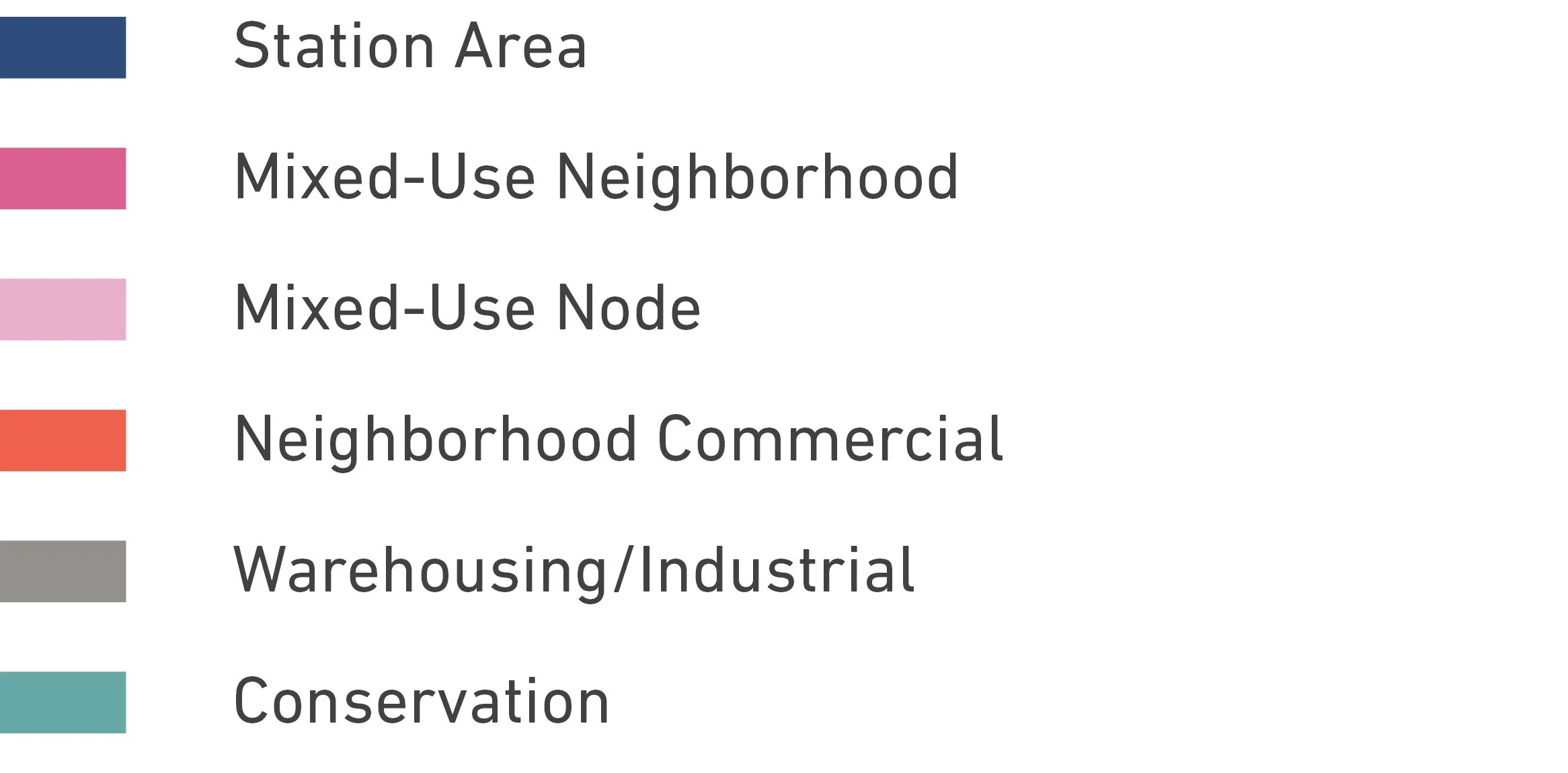
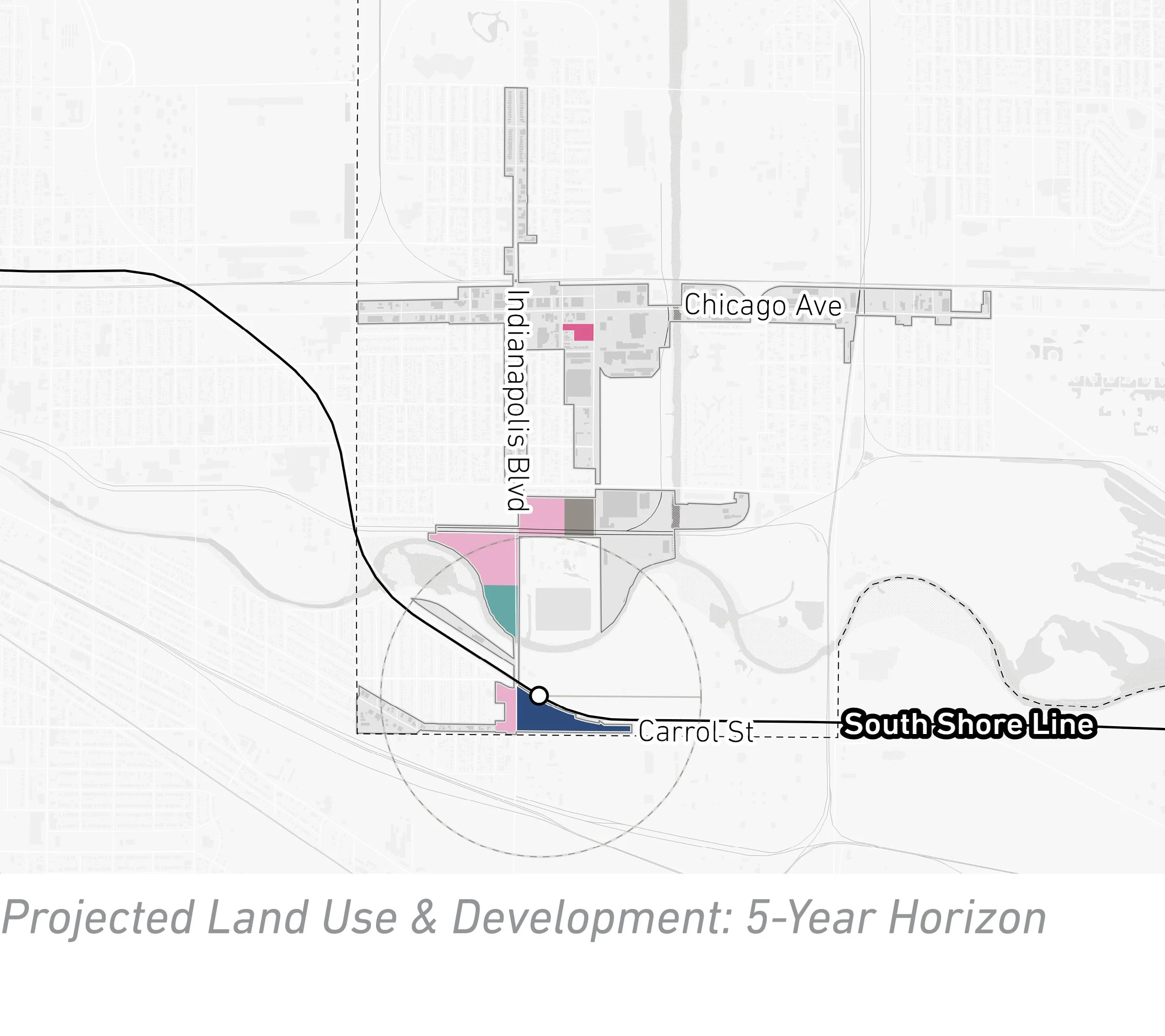
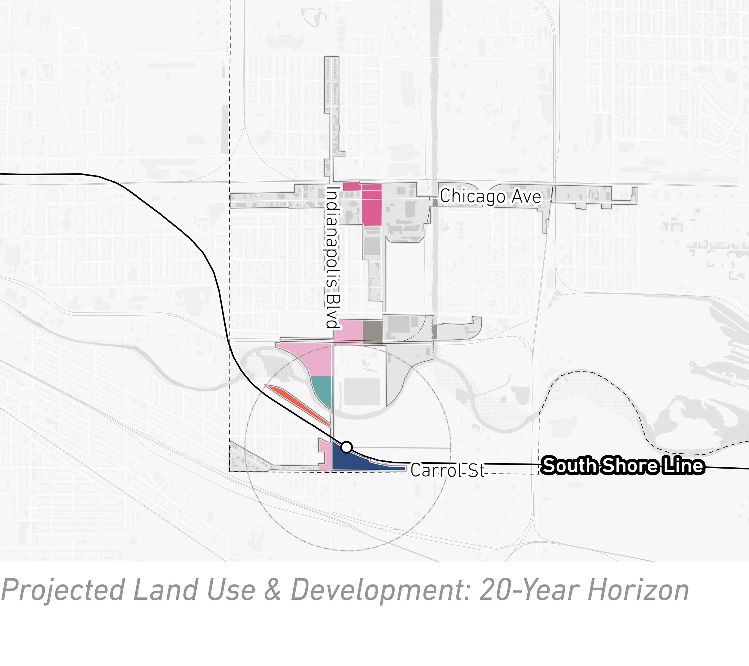
Future Land Use
The approach to future land use planning in this plan focuses on areas that are anticipated to change. Future land use is shown in general categories of land use to guide future land use and development decisions while allowing for flexibility in densities and building types.
Future development aims to create walkable linkages to the East Chicago Station with community-focused mixed-use development complementing the vibrant Roxana Neighborhood and connecting to the Marquette Greenway and Kosciuszko Park. The area directly adjacent to the station is envisioned as Mixed-Use Node land uses. Further north along Indianapolis Boulevard, industrial uses outside the 100-year floodplain along the Grand Calumet River could transition to Neighborhood Commercial, Mixed-Use Node, and Warehousing/Industrial uses while maintaining the floodplain area as a Conservation Area. Along Chicago Avenue presents an opportunity for a denser Mixed-Use Neighborhood development.
Land Use Planning
Development Concepts
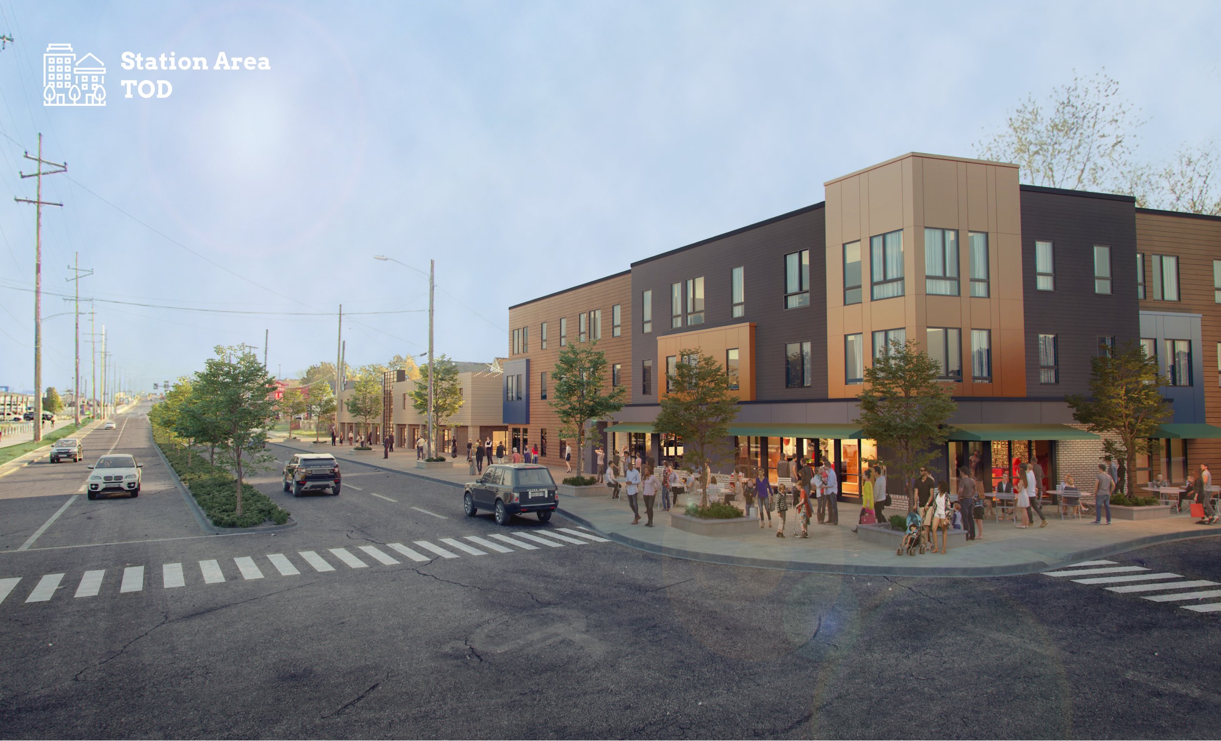
Four development opportunities were studied in this planning process and selected to illustrate the potential of TOD in more detail with scenario planning and renderings.

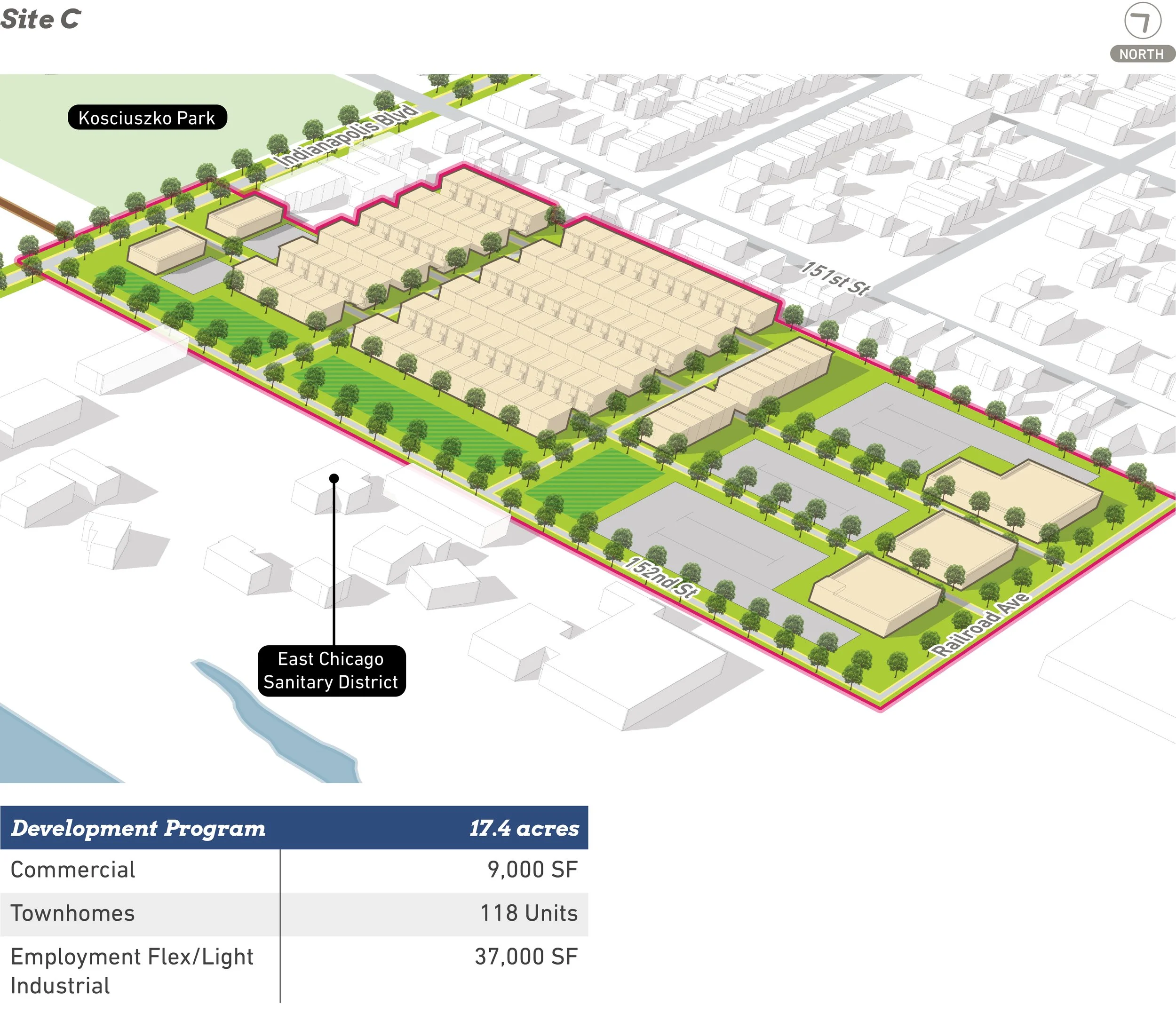


Conceptual rendering of development near the East Chicago Station (Site A)
Arc of Development
The arc of development for each community was defined collectively for selected development opportunities within the TDD boundary that projects future development potential over 5-, 10-, and 20-year time horizons. Quantitative and qualitative factors such as local/public property control, developer engagement or interest, site conditions, current regulations or future regulatory changes, among others were considered.

Development Framework
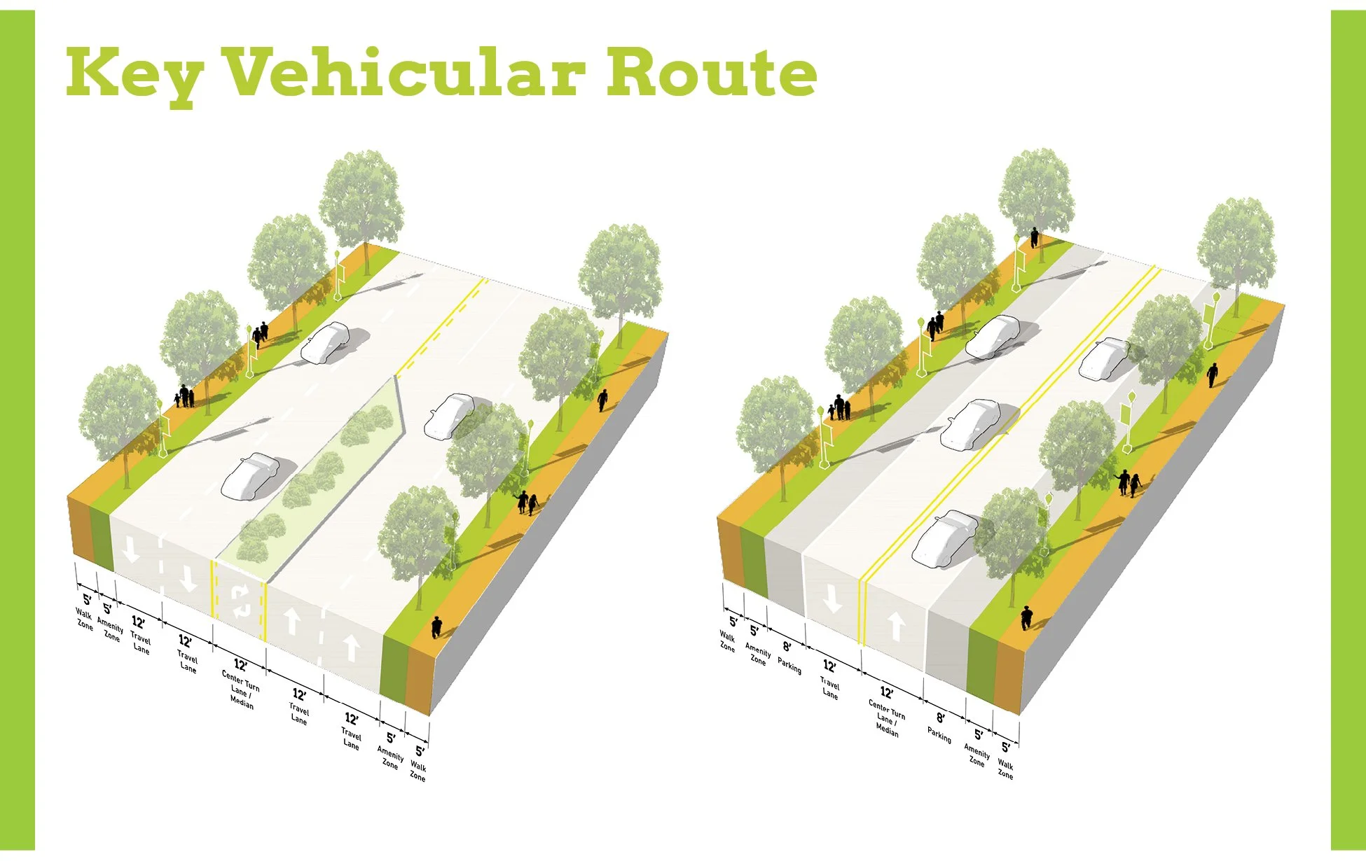
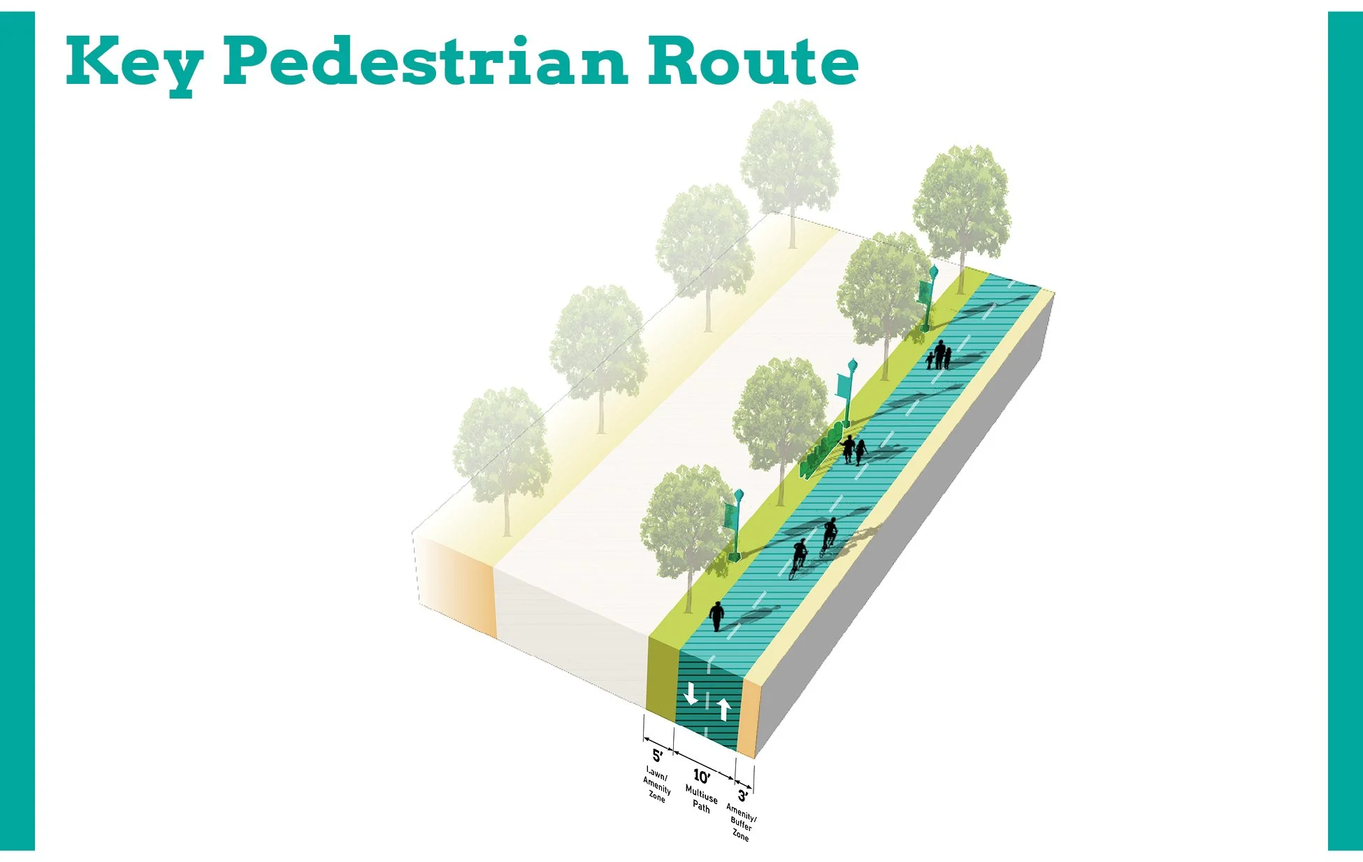
Thoroughfare Typologies
Thoroughfare Typologies were developed to analyze existing corridor conditions and create aspirational goals for future street design and streetscape.

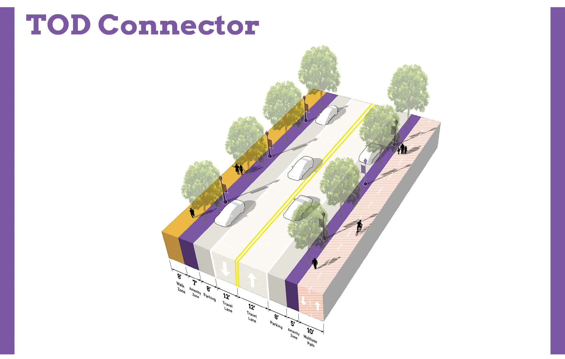


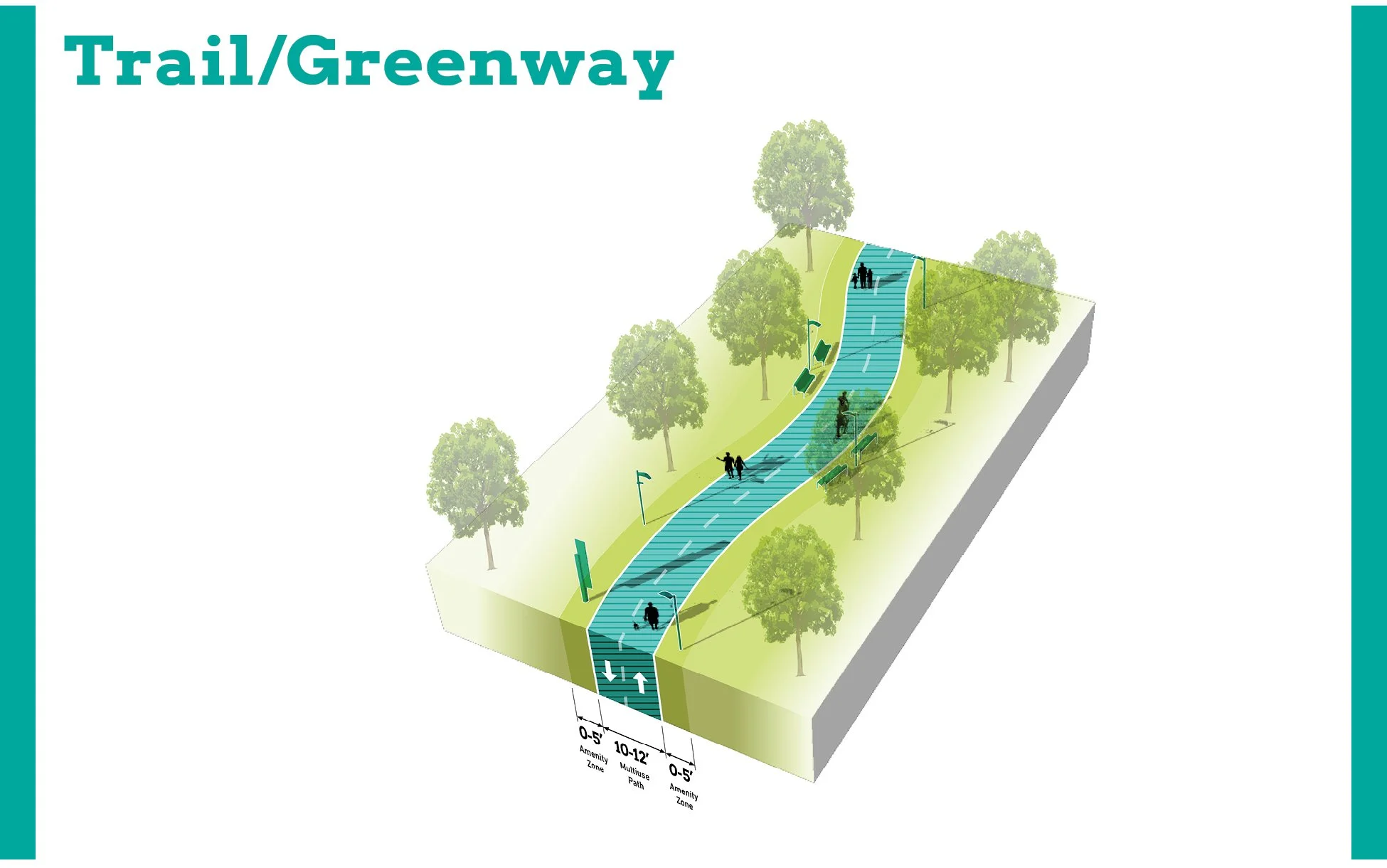
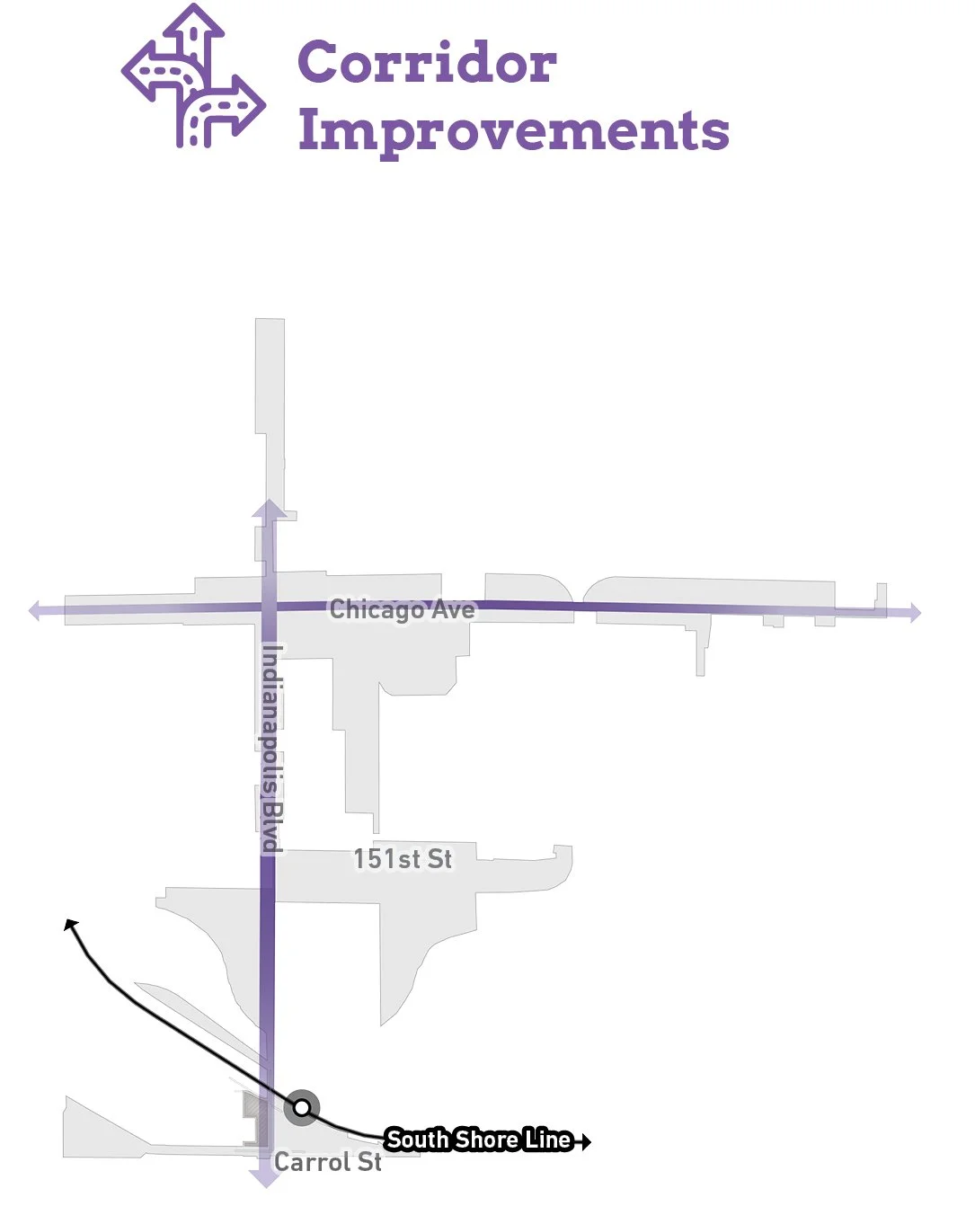
TOD Priority Thoroughfares
A portion of Indianapolis Boulevard, between 151st Street and Carrol Street, is designated as a TOD Priority Thoroughfare for its prominence in connecting the rest of the community to the station area and the need for safety improvements to promote TOD. North of 151st Street, Indianapolis Boulevard is a TOD Connector, and an INDOT improvement project is underway for this segment. South Roxana Drive is also a TOD Connector that leads from the Roxana Neighborhood to Indianapolis Boulevard and the station. Key Vehicular routes include Chicago Avenue, Kennedy Avenue, 151st Street, Carrol Street, and Michigan Street, as they make major vehicular connections throughout East Chicago and the TDD boundary. The Marquette Greenway has been built along the former railroad right-of-way south of Kosciusko Park, connecting from Hammond; an extension is planned to construct the greenway east of Indianapolis Boulevard. Enhancing pedestrian connectivity along South Roxana Drive, Chicago Avenue, and Indianapolis Boulevard will enhance walkability to the station area and throughout the city.
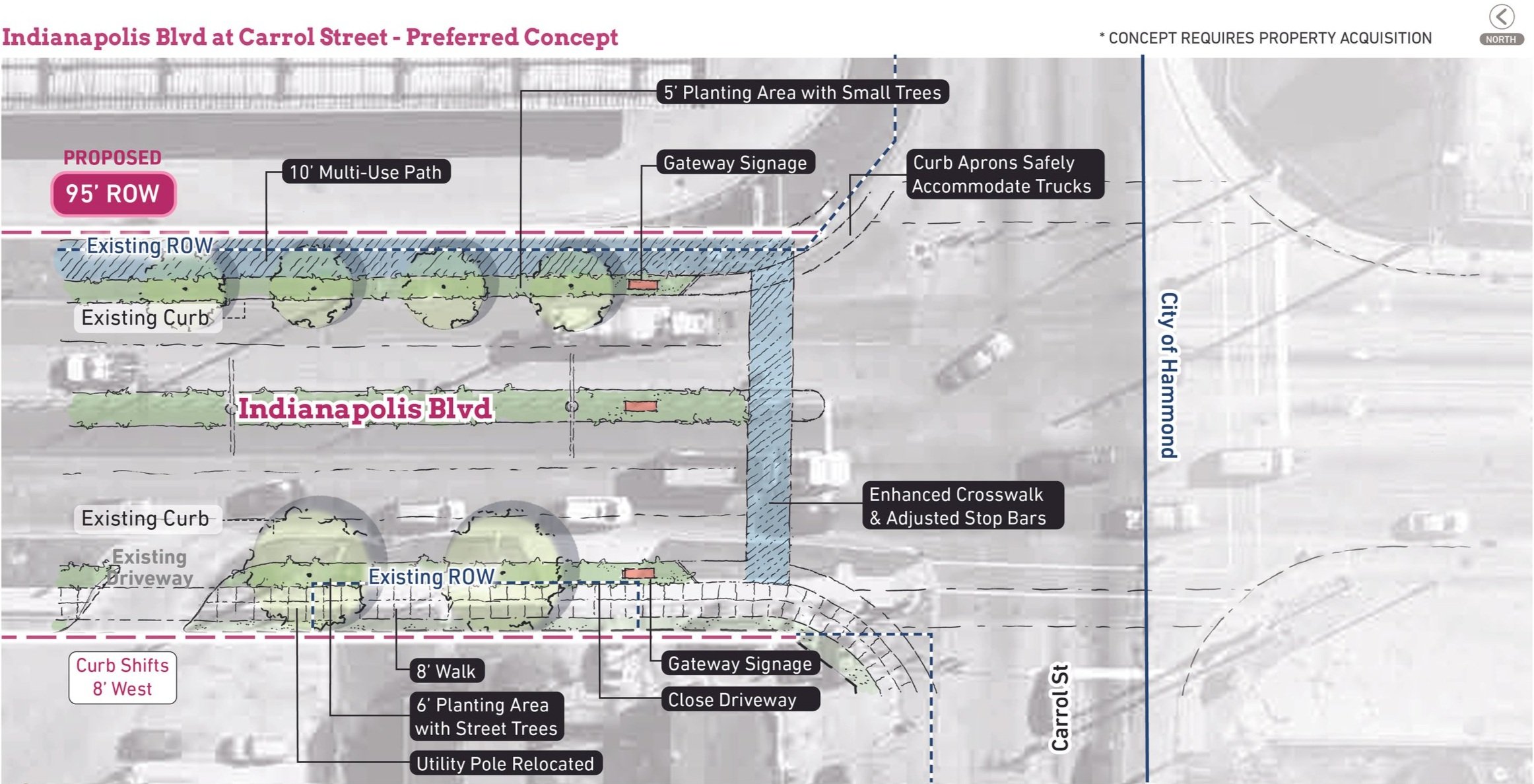
Thoroughfare & Streetscape Design
Further studies were conducted on TOD Priority Thoroughfares at the request of the local units. These studies and the corresponding order of magnitude cost estimates are included in determining possibilities for infrastructure improvements that could catalyze TOD close to the station.
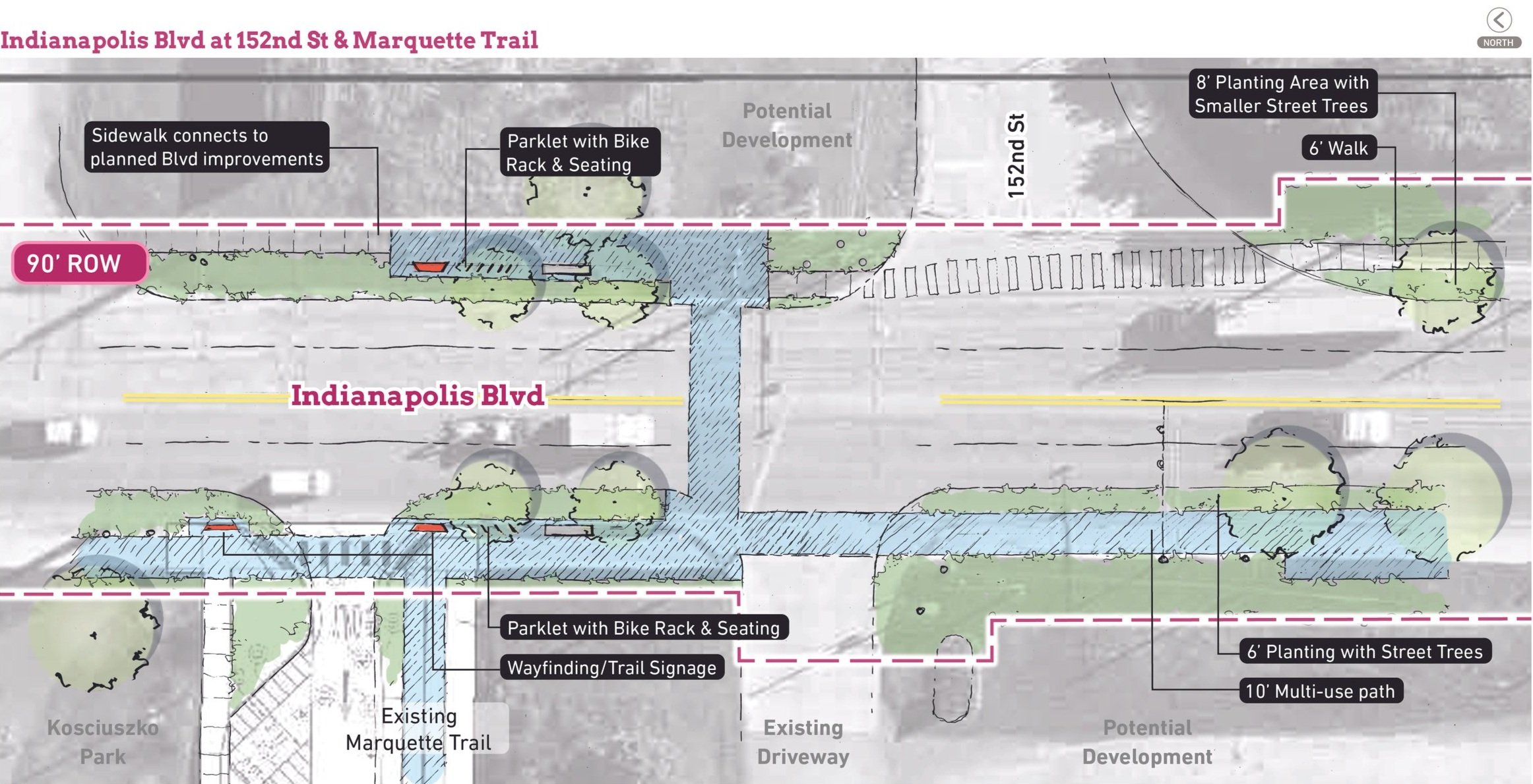
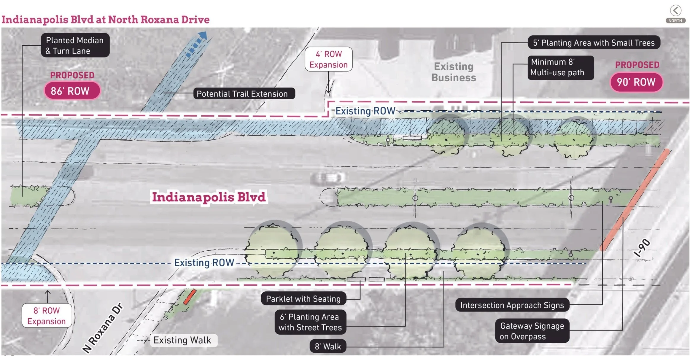
Proposed design concepts for Indianapolis Boulevard south of 152nd Street focus on connecting the station area to the Marquette Trail, creating a safer pedestrian environment, and establishing an identity for this gateway into East Chicago.

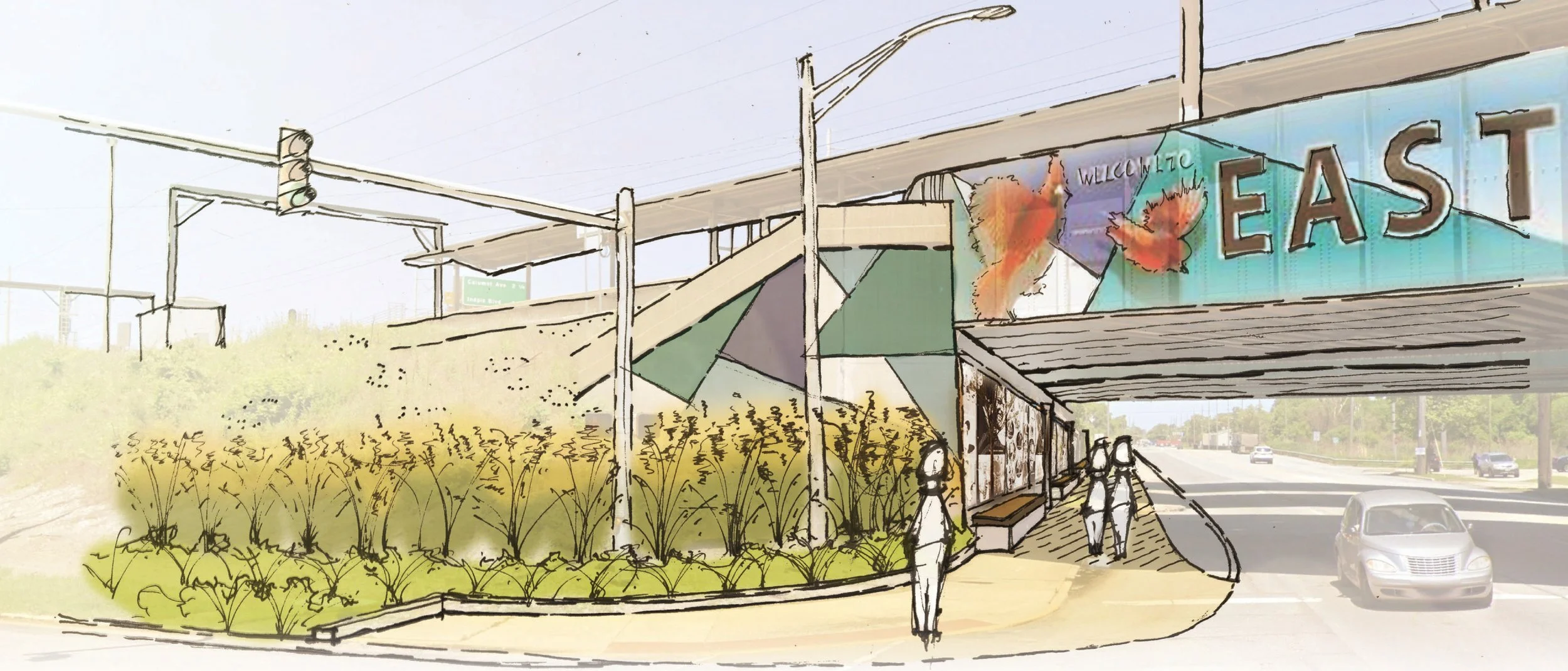
Conceptual sketch of gateway enhancements at the I-90 underpass
Infrastructure
Questions or Comments
Fill out a comment card - Contact Us
Check the FAQ section
Read through the questions below from the virtual public meeting
Browse through more information on the site which is constantly being updated
Virtual Public Presentation
See below for the full slide deck and video recording from the Virtual Public Presentation held on February 18, 2021:
Q&A
What efforts will be made to encourage the application of Universal Design Principles and compliance with ADA, Rehab Act, etc.?
This process is focused on creating the boundary itself. Detailed design of projects or the station is under separate processes. NICTD and the station design will have to comply with ADA standards.
Can new mixed-income housing focused on the workforce be included in a live-work format?
There are many different combinations for how housing can occur in any given community. Leaders of each community will likely be approached by interested developers at some point to bring their ideas to your community planning which will help guide them to what you would like to see.
Can Roxana Marsh become a riverfront liquor district to encourage new restaurants in east Chicago?
This effort is not focused on that level of planning however this planning can help encourage new development. This specific type of development planning may be something that your community has already considered or could consider in the future.
Can parks and trails be improved and built with these funds?
The funds are for those sorts of improvements and are eligible for reinvestment with the revenues collected. In the TDD boundary, things that are going to support economic development via roads, trails, open space, etc.
Why was the property south of Goodman Park on the east side of the canal left out of the boundary?
That area is a superfund site and we do see the potential for redevelopment in the future however it is most likely part of a longer strategy so our suggestion will most likely be to include it in the one-mile extension area. We felt as though other areas are more important in the closer timeframe to focus redevelopment efforts.
Grand Calumet River is dirty. Can environmental cleanup be paid for with TDD money as economic development brings dollars in?
That hasn’t specifically been studied at the moment and will be studied in the next phase. Each community will need to assess what are their priorities for investments.
Will NICTD build a parking garage in the future as demand increases?
When there is demand for development, parking lots do have the opportunity to be converted into other types of development with potential vertical parking. If East Chicago did see demand for this kind of density and development at the station area, it would be a great success this or other station areas.
What new kinds of housing are being built around stations across the U.S.?
What we typically see around transit is that there is a good amount of stable single-family housing so new housing that typically gets developed is smaller format multi-family, townhomes, and mixed-use. What we do not typically see a lot of, although demand is growing, are things like duplexes, quads, cottage homes, condominiums, etc. We are seeing interesting housing products being built around station areas that really cater to a different market demand where people have new choices.
Español
Para subtítulos en español, active los subtítulos opcionales y configúrelos en español.
El tablón de la derecha comparte información sobre el proceso y el proyecto de límites.