Ridge Road Station
West Lake Line
Munster, Indiana
Last Updated: October 2023
TOD Strategic Implementation Plan
Following the TDD boundary being established October 31, 2022, the team worked closely with the Town of Munster to identify and collaboratively advance planning for the community to be proactive about future TOD.
At the conclusion of this process, control of local land use and zoning remains with the cities and towns. This process aims to provide proactive guidance and recommendations that the local units can use to advance their planning processes, resulting in updated comprehensive plans, area plans, and zoning ordinances complete with locally-controlled public input.
Community Priorities & Opportunities
Big Moves
“Big Moves” are defined as enabling steps to signal to the market that conditions are right for transit-oriented development to occur.
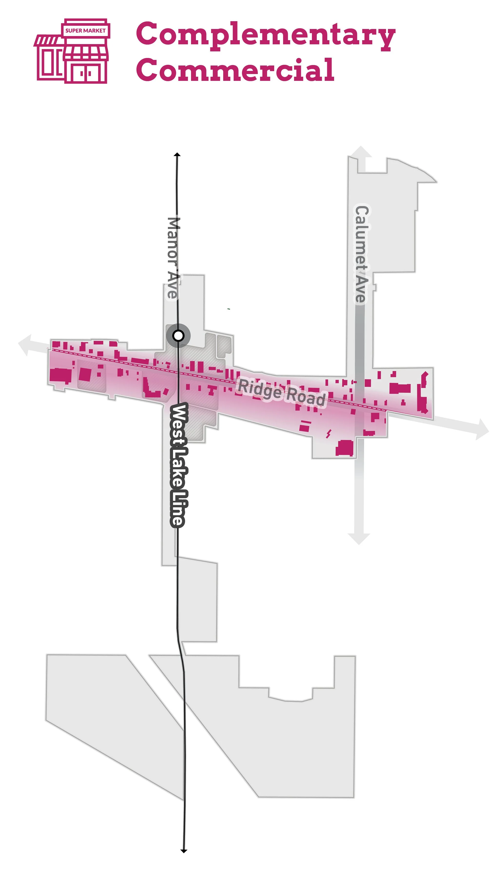
The opportunity for medium-density mixed-use TOD exists around the immediate station area. Walkability should be enhanced to the station area from nearby traditional neighborhoods and commercial corridors. Multiple opportunity sites for mixed-use development also exist along Ridge Road. Development should be complementary to the existing walkable commercial area and residential neighborhoods around the station. Ridge Road and Calumet Avenue streetscape improvements have been planned and designed for these two important commercial corridors. The Munster community has the unique ability to attract multiple housing types near the station.


Areas of Impact
Areas of Impact were established to distinguish between major (re)development areas, both TOD and non-TOD, and areas to be maintained, preserved, and enhanced. These designations begin to direct development activity and other targeted investments based on proximity and relationship to the station area.
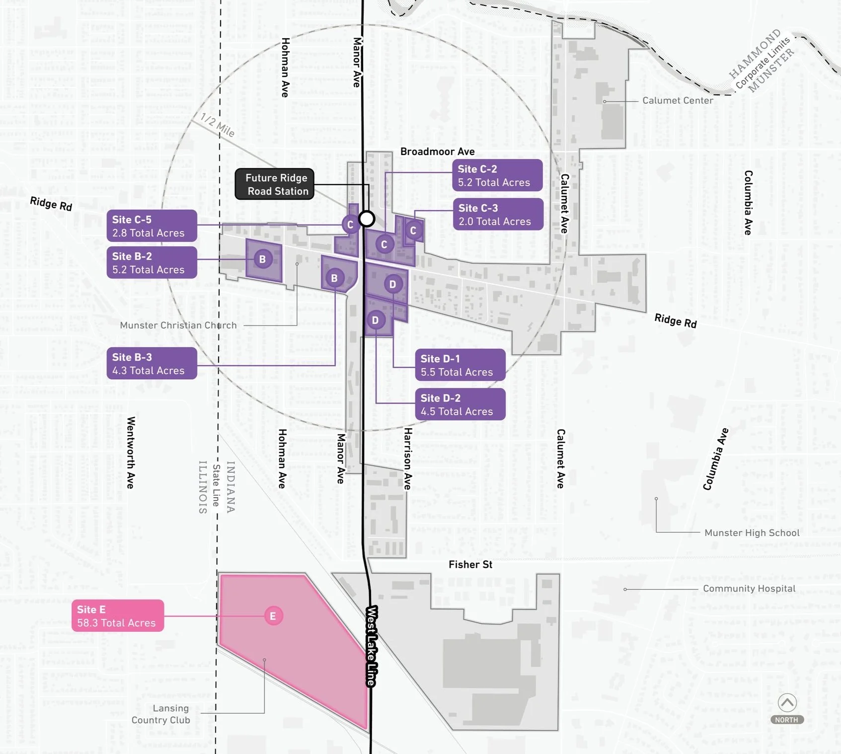
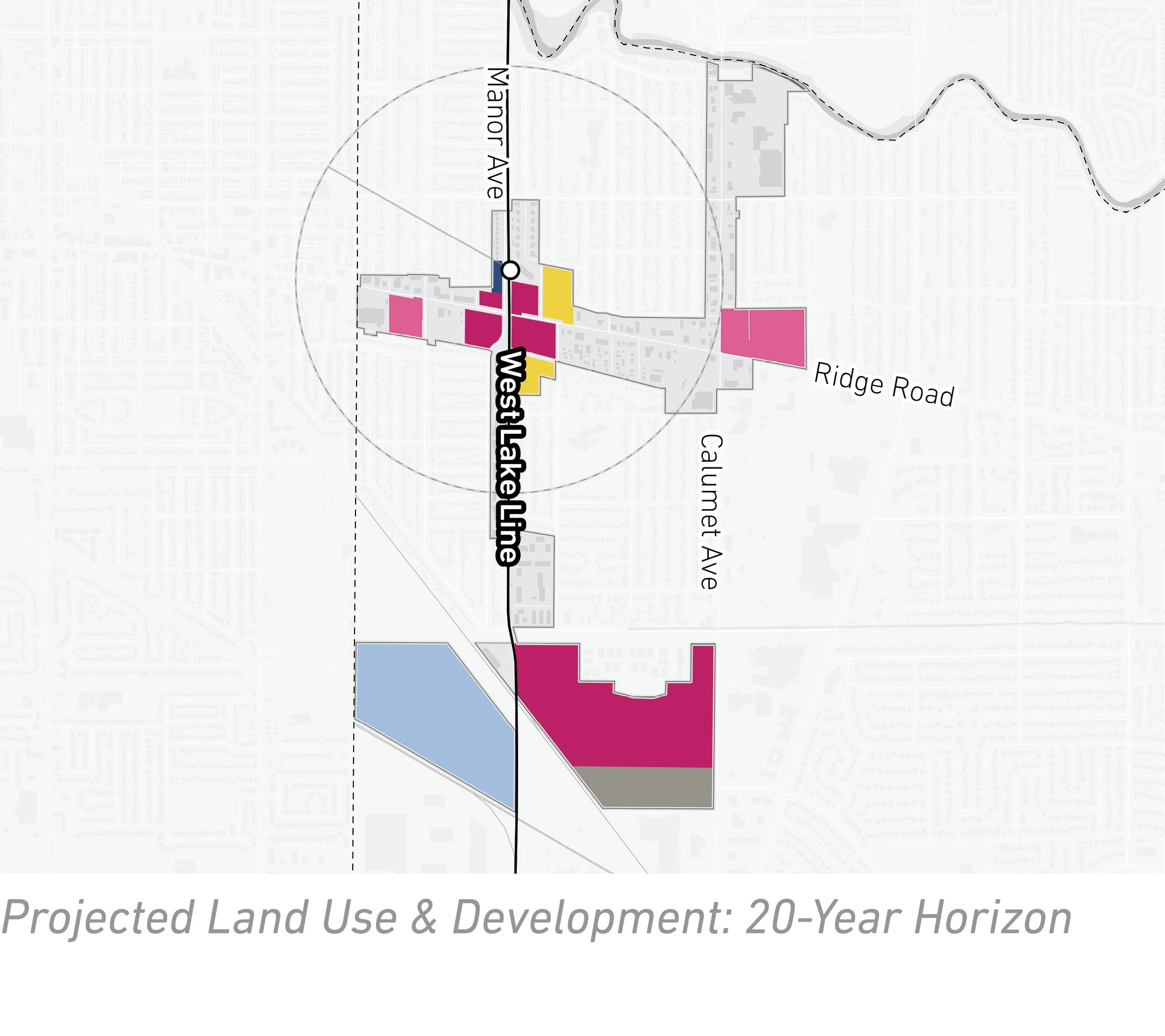
Future transit-oriented development is recommended to focus on the Ridge Road corridor surrounding the future station and rail corridor. Several sites immediately surrounding the Future Ridge Road Station and the Ridge Road corridor have been identified as having potential for (re)development. The Lansing Country Club (Site E) to the south of the station is an Area of Significant Change as it presents a nearly 58-acre redevelopment opportunity to potentially transition from a golf course to an employment center.
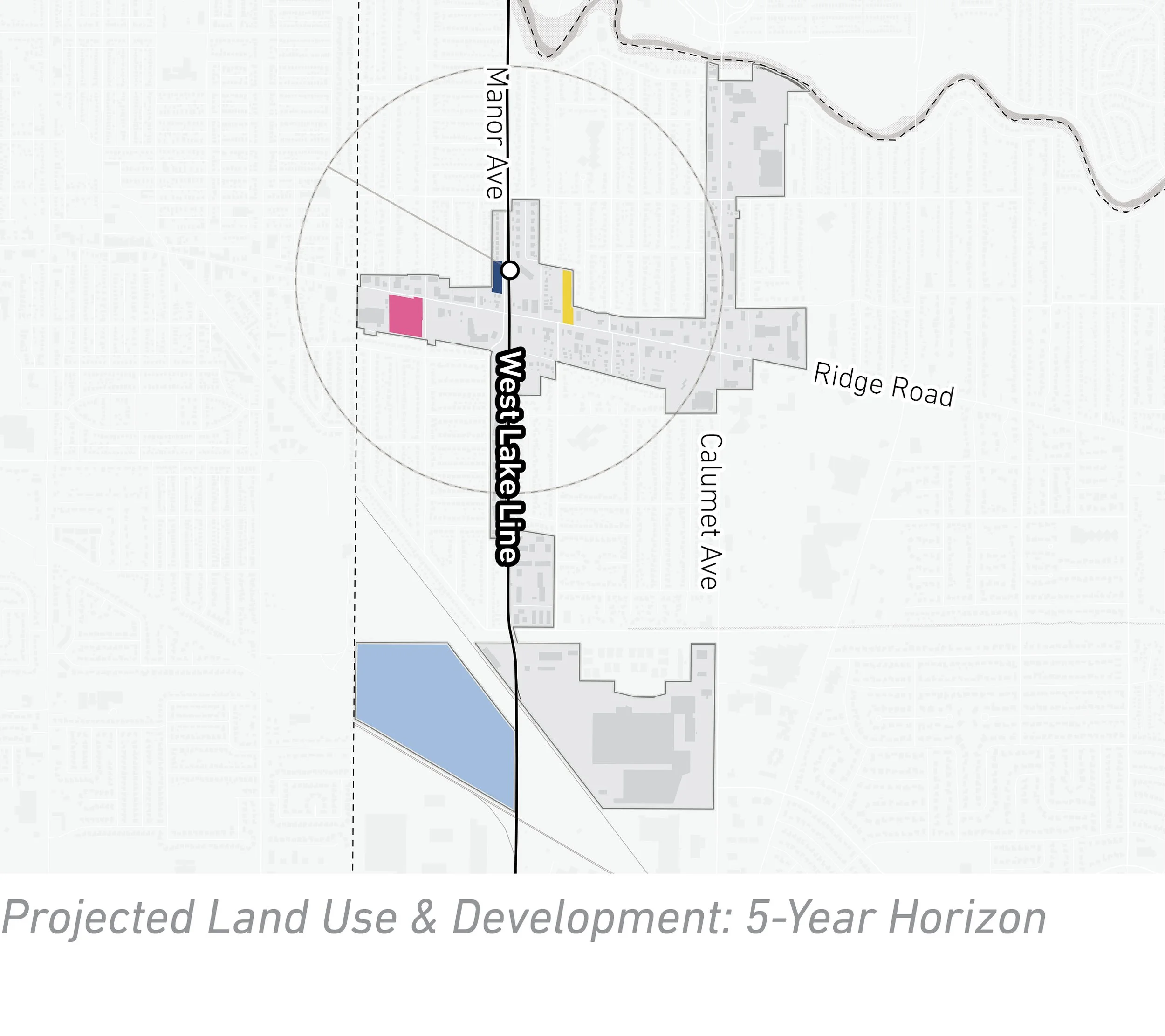
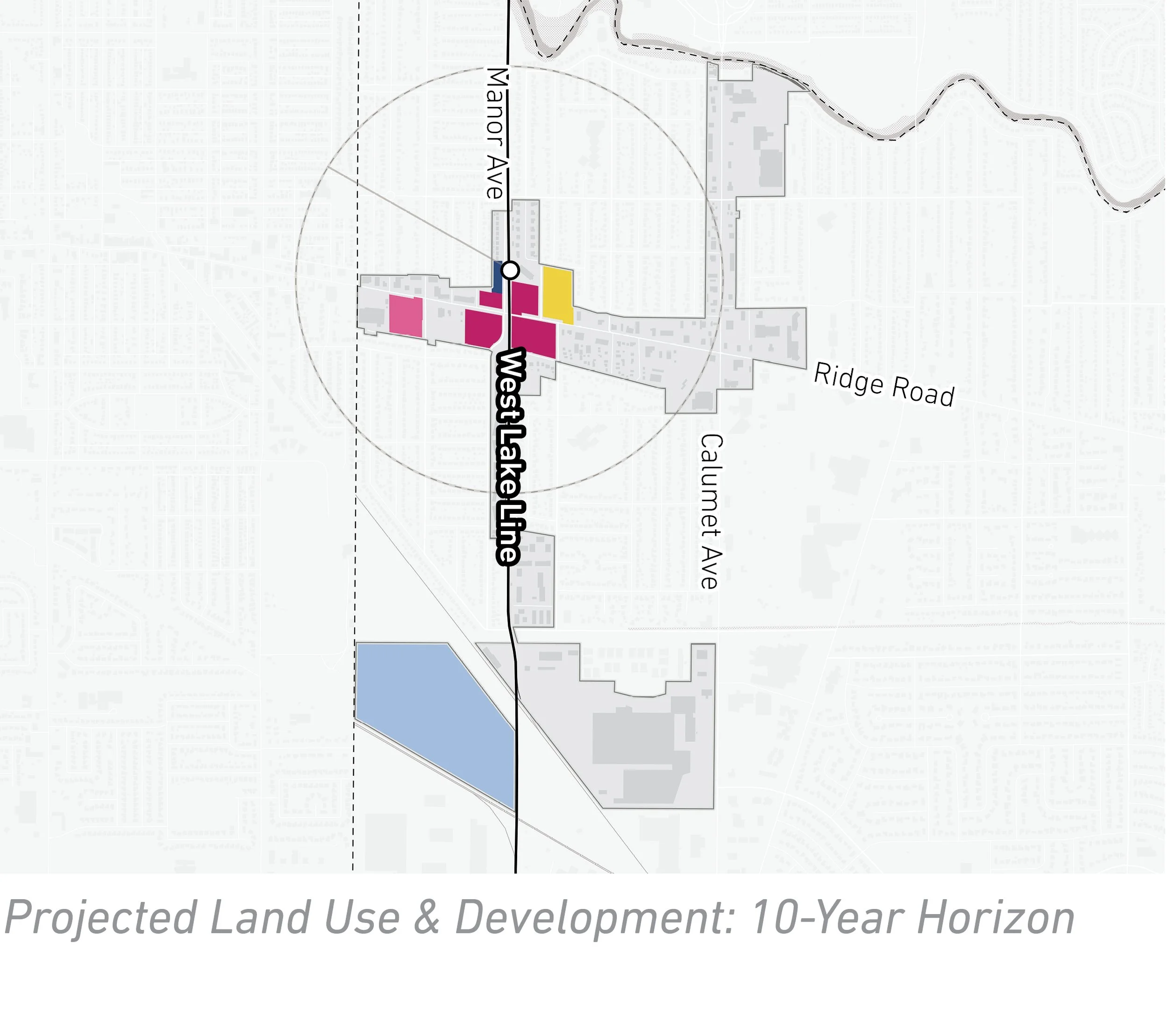
Future Land Use
The approach to future land use planning in this plan focuses on areas that are anticipated to change. Future land use is shown in general categories of land use to guide future land use and development decisions while allowing for flexibility in densities and building types.
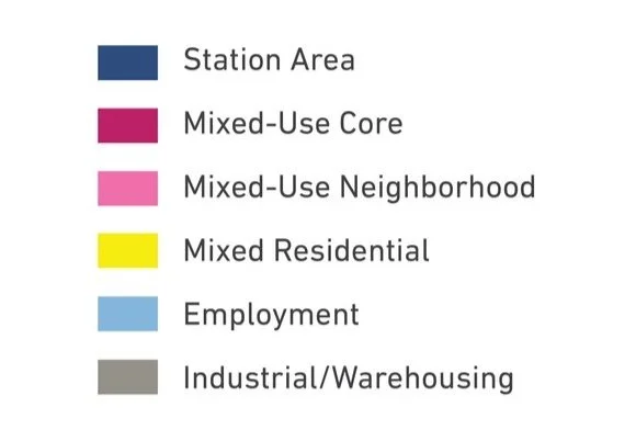
Future land use establishes Mixed-Use Core areas immediately surrounding the Future Ridge Road Station and Ridge Road. A portion of land to the west of the future West Lake Line is reserved as Station Area land use for surface commuter parking. Opportunities for Mixed-Use Neighborhoods exist further along Ridge Road. Beyond Ridge Road, land uses transition into residential neighborhoods as Mixed Residential. The future of the Lansing Country Club is anticipated to redevelop as Employment/Office uses. There is potential for Mixed-Use Core development with Industrial/Warehousing to enhance the Lake Business Center.
Land Use Planning


Development Framework
Development Concepts
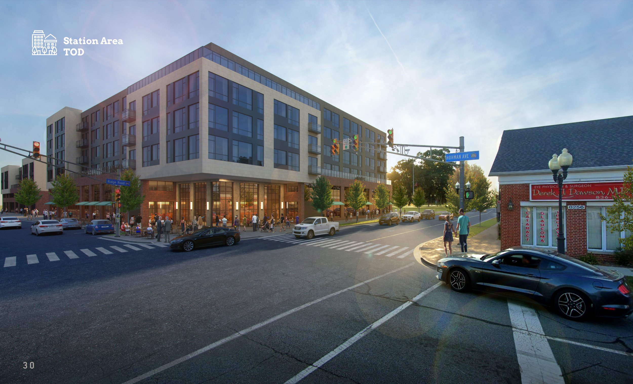
One development opportunity was studied in this planning process and selected to illustrate the potential of TOD in more detail with scenario planning and a rendering.
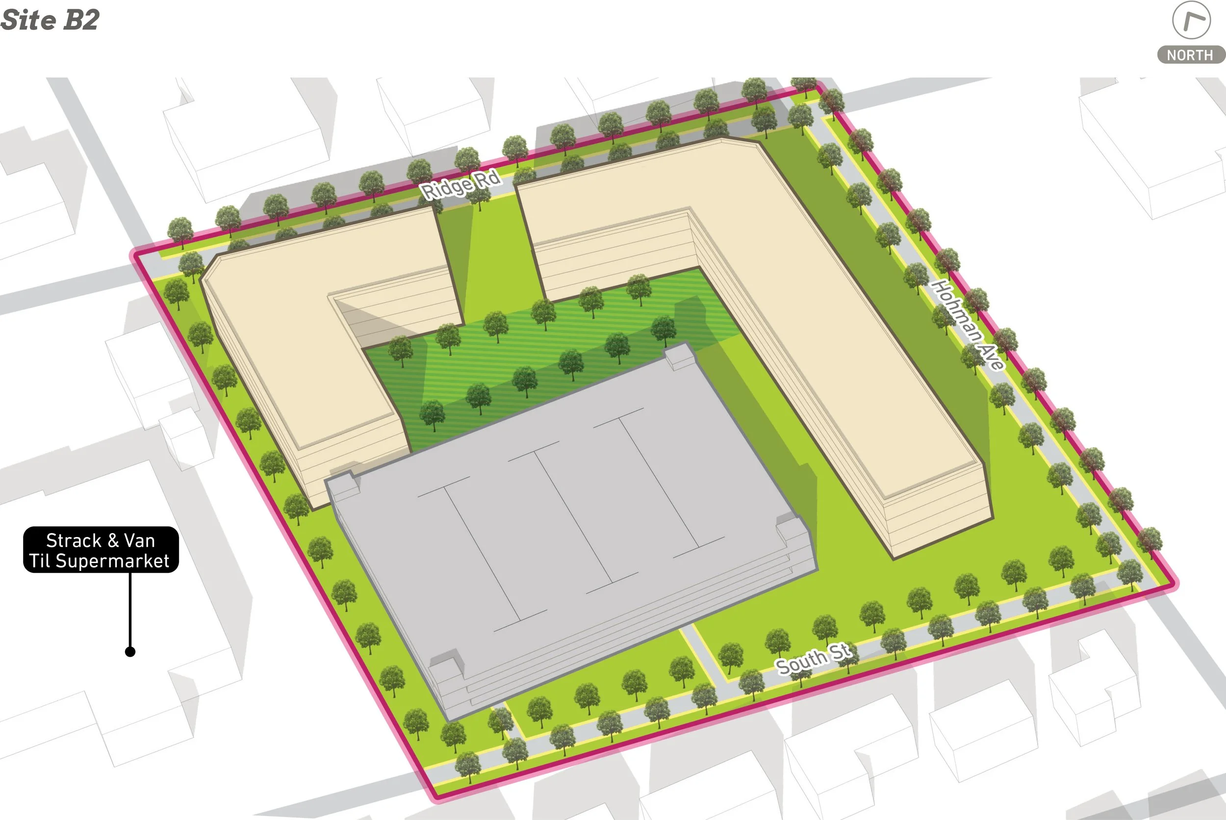
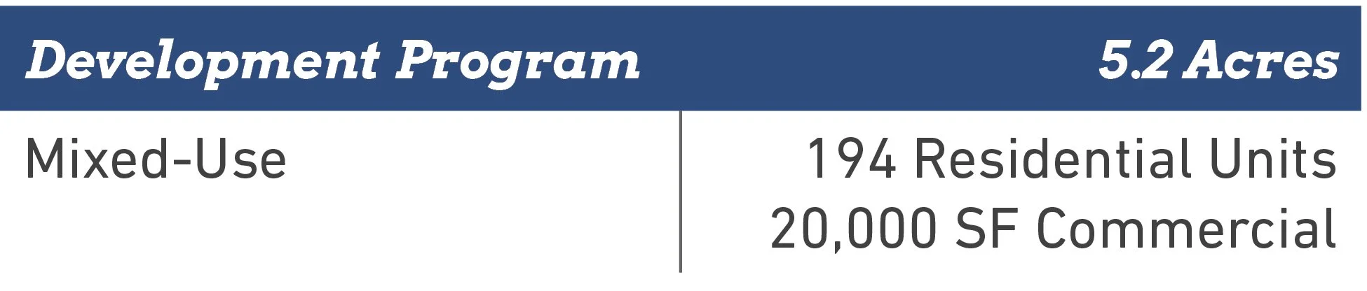

Conceptual rendering of development near the future Ridge Road Station (Site B2).
Arc of Development
The arc of development for each community was defined collectively for selected development opportunities within the TDD boundary that projects future development potential over 5-, 10-, and 20-year time horizons. Quantitative and qualitative factors such as local/public property control, developer engagement or interest, site conditions, current regulations or future regulatory changes, among others were considered.
Infrastructure
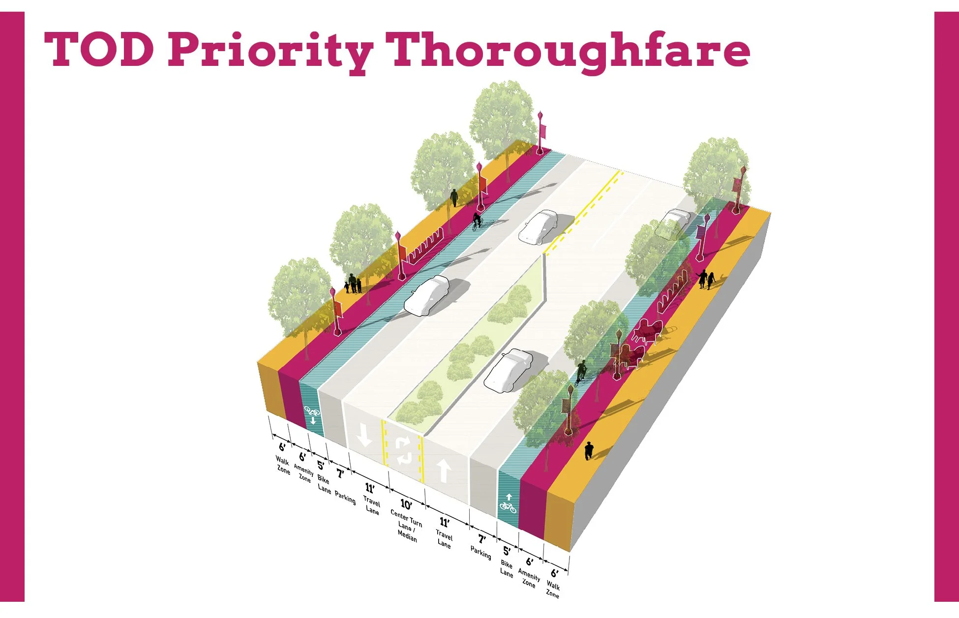
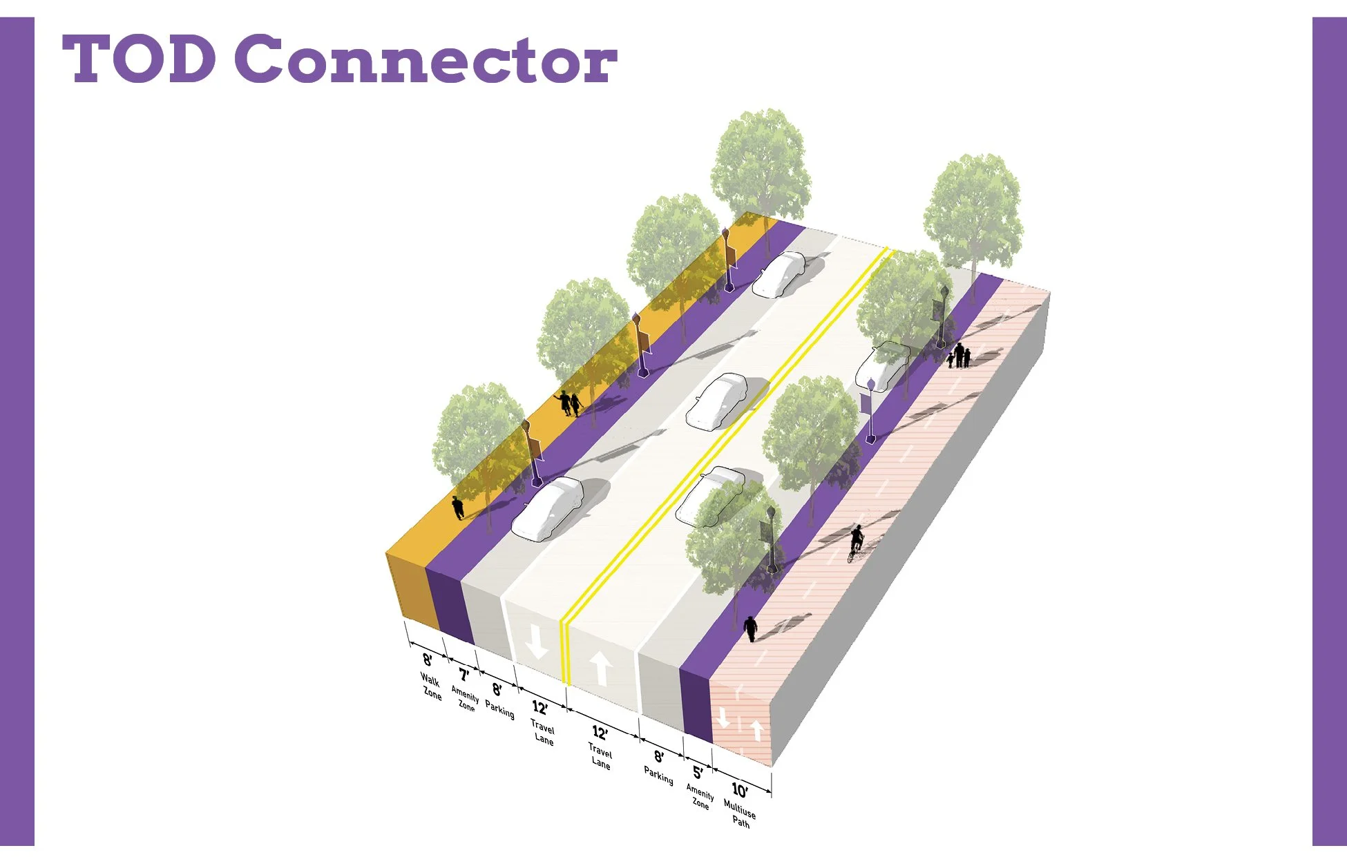
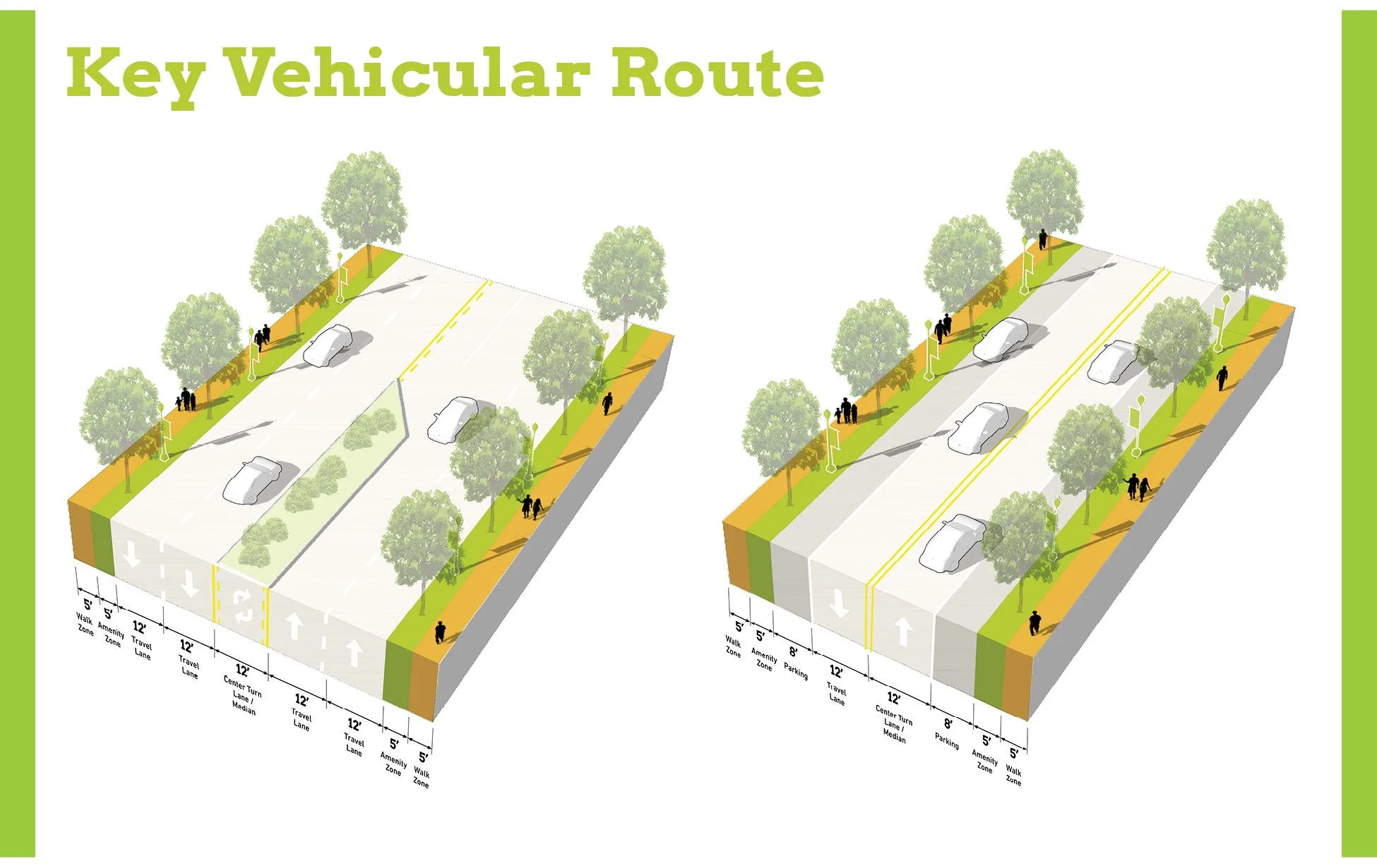
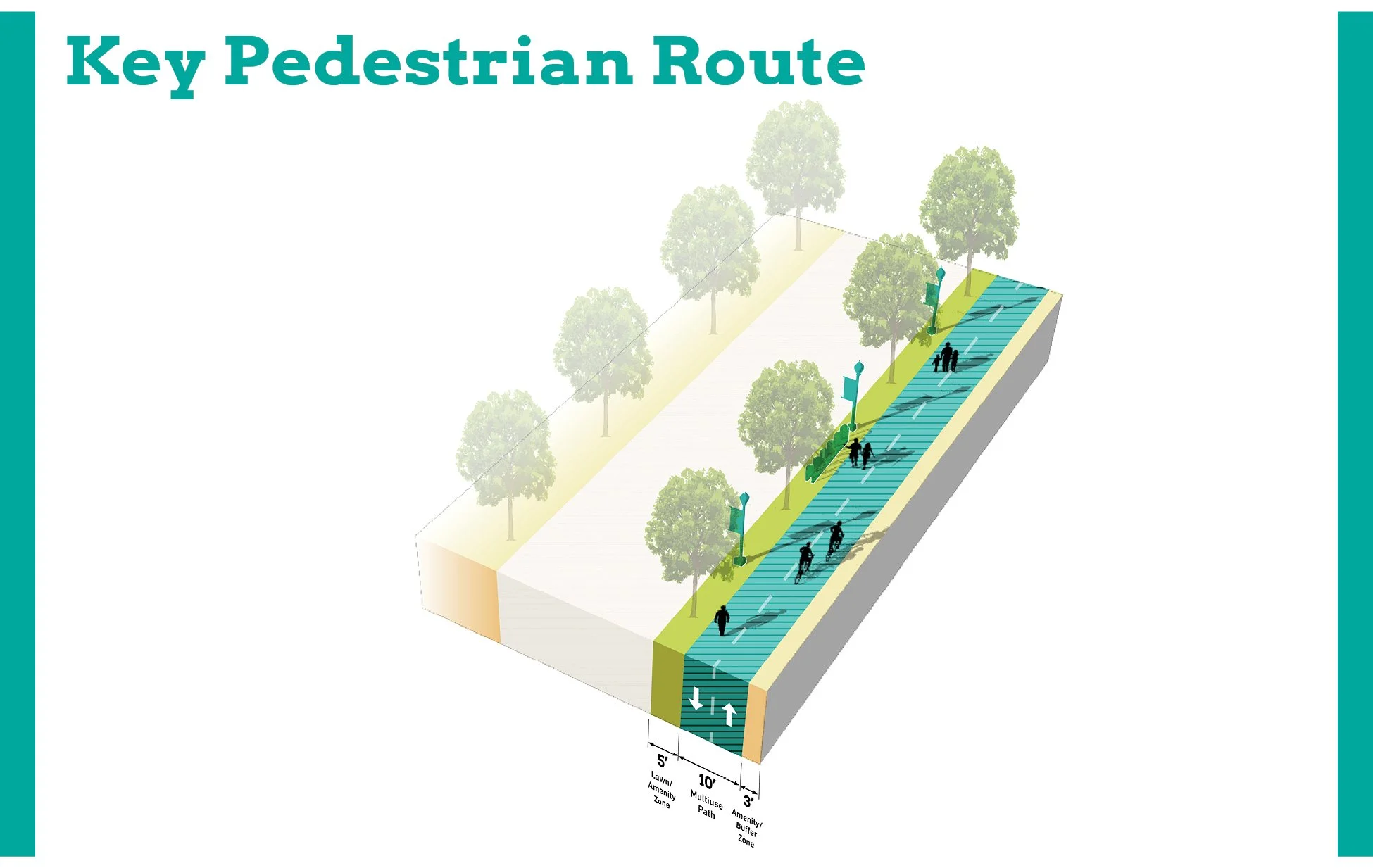
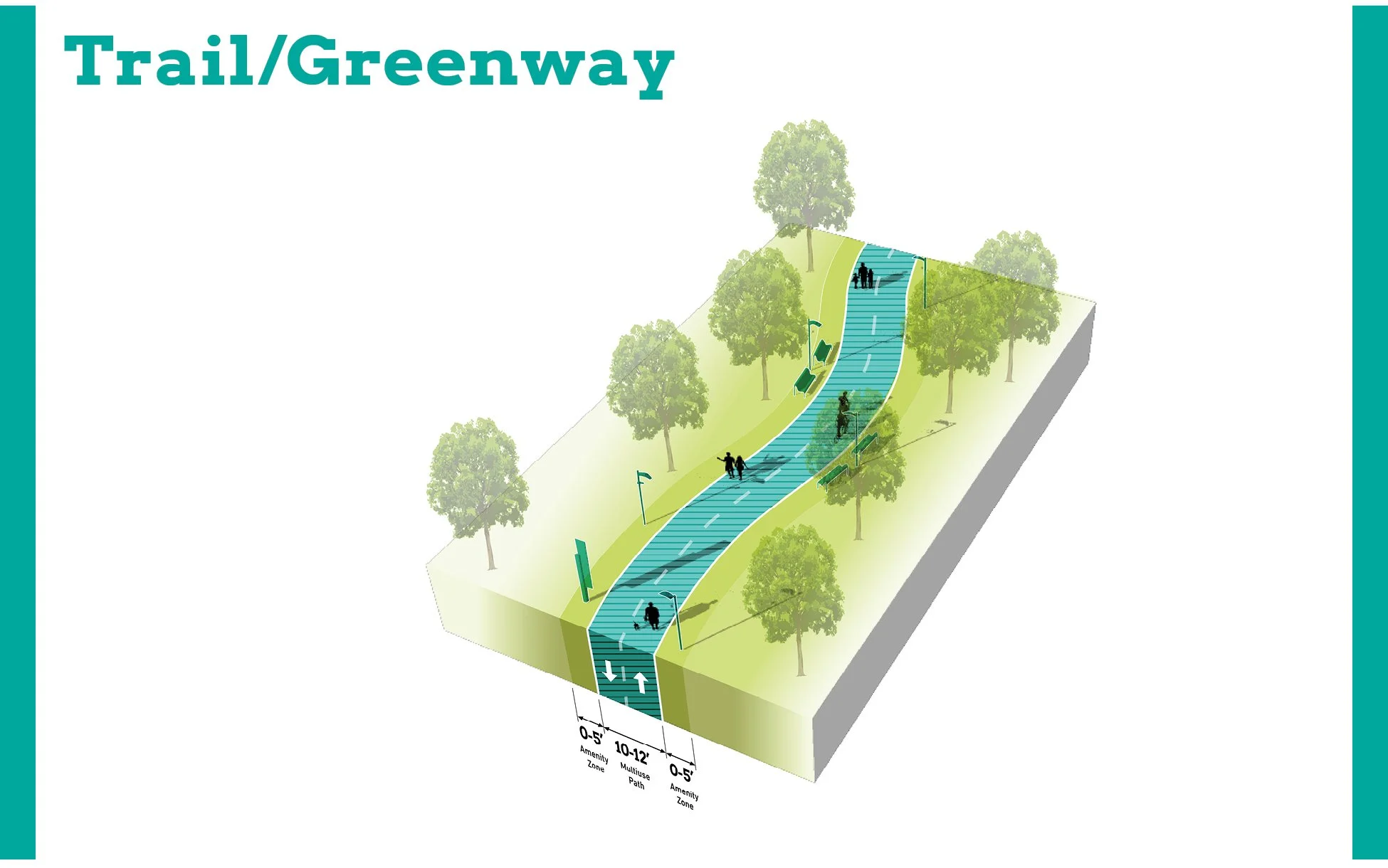
Thoroughfare Typologies
Thoroughfare Typologies were developed to analyze existing corridor conditions and create aspirational goals for future street design and streetscape.
TOD Priority Thoroughfares
Ridge Road between the State Line and Calumet Avenue is designated as TOD Priority Thoroughfare as the primary vehicular access point to the future station. Calumet Avenue and Fisher Street serve as TOD Connectors that create easy access to Ridge Road from other high-traffic areas. Broadmoor Avenue, Columbia Avenue, Manor Avenue, and portions of Ridge Road east of Calumet Avenue are designated as Key Vehicular Routes that primarily function to move vehicles through the area. The Ridge Road Station Area benefits immensely from access to both the Pennsy Greenway and the Monon Trail. The West Lake Line is planned to align with the existing Monon Trail through this portion of Munster, and an extension of the trail is being planned that would continue parallel to the West Lake Line toward the Little Calumet River.


Questions or Comments
Fill out a comment card - Contact Us
Check the FAQ section
Read through the questions below from the virtual public meeting
Browse through more information on the site which is constantly being updated
Virtual Public Presentation
See below for the full slide deck and video recording from the Virtual Public Presentation held on November 18, 2020:

Q&A
I thought the IN legislature passed legislation authorizing the RDA to use eminent domain for development projects.
The TDD legislation (IC 36-7.5-4.5 et seq) does not authorize use of eminent domain by the RDA.
Also TIF related to TDD allows revenue to go to other taxing districts.
Incremental revenue collected within individual boundaries must be reinvested within the same boundary. If TDD and TIF boundaries overlap, the RDA and local government would enter into a memorandum of agreement to determine how revenues are managed so that the TIF obligations are always met.
For those of us who live within the TDD boundary, will our taxes go up?
Establishment of the TDD boundary only allows the capture of incremental tax revenue. The TDD legislation does not authorize a new tax or levy.
What impact do you anticipate the project to have on existing businesses and residential properties within the TDD and TIF boundaries?
There is a tremendous opportunity to positively impact community growth, which enhances existing businesses and residential properties. Anticipated growth outcomes include new community-oriented development and new infrastructure such as streets, bridges, trails, and open space.
Does this overall plan include first mile/ last mile transportation, such as AV shuttles?
The effort is focused on establishing TDD boundaries will determine where incremental revenues can be collected and reinvested.